
Mount Kilimanjaro
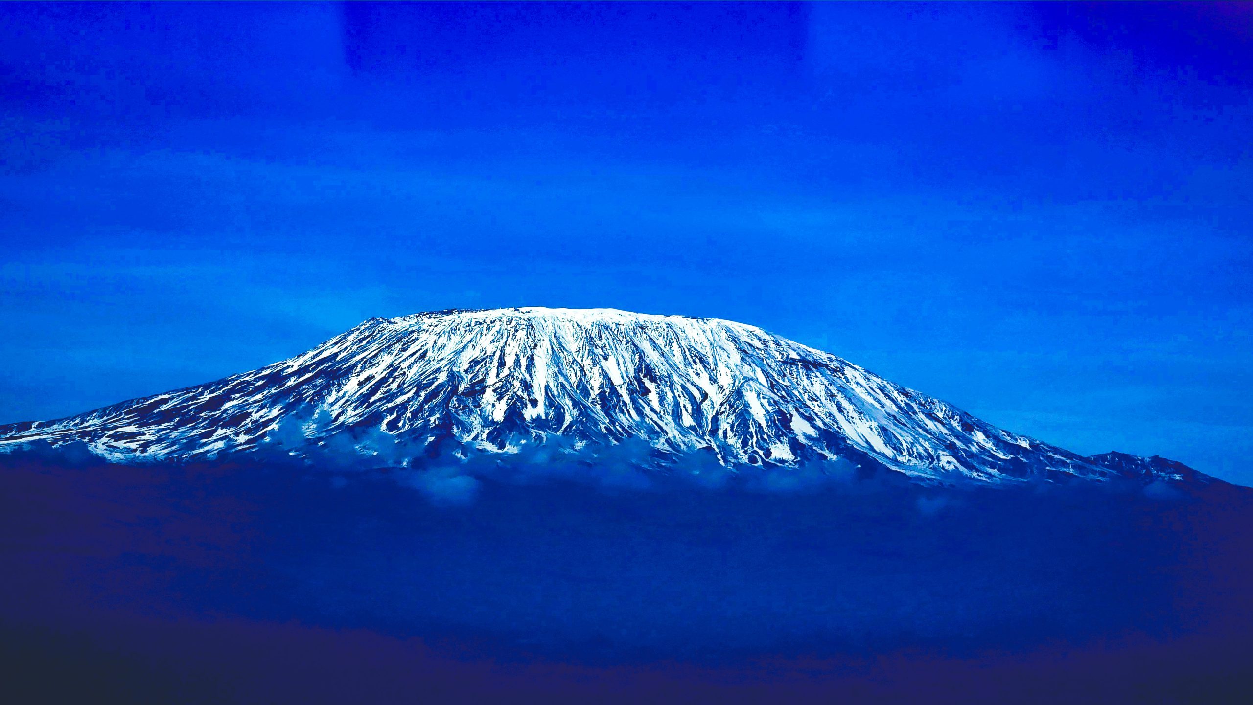
Mount Kilimanjaro is a dormant volcano located in Kilimanjaro Region of Tanzania. It has three volcanic cones: Kibo, Mawenzi, and Shira. It is the highest mountain in Africa and the highest single free-standing mountain above sea level in the world: 5,895 m (19,341 ft) above sea level and about 4,900 m (16,100 ft) above its plateau base.Kilimanjaro is the fourth most topographically prominent peak on Earth. It is part of Kilimanjaro National Park and is a major hiking and climbing destination. Because of its shrinking glaciers and ice fields, which are projected to disappear between 2025 and 2035, it has been the subject of many scientific studies.
Others have assumed that kilima is Kiswahili for mountain. The problem with this assumption is that kilima actually means hill and is, therefore, the diminutive of mlima, the proper Kiswahili word for mountain. However, it is not possible, that an early European visitor, whose knowledge of [Kiswahili] was not extensive, changed mlima to kilima by analogy with the two Wachagga names: Kibo and Kimawenzi.”. A different approach is to assume that the kileman part of Kilimanjaro comes from the Kichagga kileme, which means that which defeats, or kilelema, which means that which has become difficult or impossible. The jaro part would “then be derived from njaare, a bird; or, according to other informants, a leopard; or, possibly from jyaro, a caravan”. Considering that the name Kilimanjaro has never been current among the Wachagga people, it is possible that the name was derived from Wachagga saying that the mountain was unclimbable, kilemanjaare or kilemajyaro, and porters misinterpreting this as being the name of the mountain.
In the 1880s, the mountain became a part of German East Africa and was called Kilima-Ndscharo in German following the Kiswahili name components. On 6 October 1889, Hans Meyer reached the highest summit on the crater ridge of Kibo. He named it Kaiser-Wilhelm-Spitze (Kaiser Wilhelm peak). That name was used until Tanzania gained her independence in 1964 when the summit was renamed Uhuru Peak, meaning freedom peak in Kiswahili.
A map of the Kibo cone on Mount Kilimanjaro was published by the British government’s Directorate of Overseas Surveys (DOS) in 1964 based on aerial photography conducted in 1962 as the “Subset of Kilimanjaro, East Africa (Tanganyika) Series Y742, Sheet 56/2, D.O.S. 422 1964, Edition 1, Scale 1:50,000”. Tourist mapping was first published by the Ordnance Survey in England in 1989 based on the original DOS mapping at a scale of 1:100,000, with 100 ft (30 m) contour intervals, as DOS 522. West Col Productions produced a map with tourist information in 1990, at a scale of 1:75,000, with 100 m (330 ft) contour intervals; it included inset maps of Kibo and Mawenzi on 1:20,000 and 1:30,000 scales respectively and with 50 m (160 ft) contour intervals. In recent years, numerous other maps have become available, of various qualities.
The volcanic interior of Kilimanjaro is poorly known because there has not been any significant erosion to expose the igneous strata that comprise the volcano’s structure.
Eruptive activity at the Shira centre commenced about 2.5 million years ago, with the last important phase occurring about 1.9 million years ago, just before the northern part of the edifice collapsed. Shira is topped by a broad plateau at 3,800 m (12,500 ft), which may be a filled caldera. The remnant caldera rim has been degraded deeply by erosion. Before the caldera formed and erosion began, Shira might have been between 4,900 and 5,200 m (16,100 and 17,100 ft) high. It is mostly composed of basic lavas, with some pyroclastics.
Both Mawenzi and Kibo began erupting about 1 million years ago. They are separated by the Saddle Plateau at 4,400 m (14,400 ft) elevation.
The youngest dated rocks at Mawenzi are about 448,000 years old. Mawenzi forms a horseshoe-shaped ridge with pinnacles and ridges opening to the northeast, with a tower-like shape resulting from deep erosion and a mafic dike swarm.
Kibo is the largest cone on the mountain and is more than 24 km (15 mi) wide at the Saddle Plateau altitude. The last activity here, dated to 150,000–200,000 years ago, created the current Kibo summit crater. Kibo still has gas-emitting fumaroles in its crater. Kibo is capped by an almost symmetrical cone with escarpments rising 180 to 200 m (590 to 660 ft) on the south side. These escarpments define a 2.5 km-wide (1.6 mi) caldera caused by the collapse of the summit.
An almost continuous layer of lava buries most older geological features, with the exception of exposed strata within the Great West Notch and the Kibo Barranco. The former exposes intrusions of syenite. Kibo has five main lava formations:
• Phonotephrites and tephriphonolites of the Lava Tower group, on a dyke cropping out at 4,600 m (15,100 ft), dated to 482,000 years ago.
• Tephriphonolite to phonolite lavas “characterized by rhomb mega-phenocrysts of sodic feldspars” of the Rhomb Porphyry group, dated to 460,000–360,000 years ago.
• Aphyric phonolite lavas, “commonly underlain by basal obsidian horizons”, of the Lent group, dated to 359,000–337,000 years ago.
• Porphyritic tephriphonolite to phonolite lavas of the Caldera Rim group, dated to 274,000–170,000 years ago.
• Phonolite lava flows with aegirine phenocrysts, of the Inner Crater group, which represents the last volcanic activity on Kibo
Kibo has more than 250 parasitic cones on its northwest and southeast flanks that were formed between 150,000 and 200,000 years ago and erupted picrobasalts, trachybasalts, ankaramites, and basanites. They reach as far as Lake Chala and Taveta in the southeast and the Lengurumani Plain in the northwest. Most of these cones are well preserved, apart from the Saddle Plateau cones that were heavily affected by glacial action. Despite their mostly small size, lava from the cones has obscured large portions of the mountain. The Saddle Plateau cones are mostly cinder cones with terminal effusion of lava, while the Upper Rombo Zone cones mostly generated lava flows. All Saddle Plateau cones predate the last glaciation.
According to reports gathered in the 19th century from the Maasai, Lake Chala on Kibo’s eastern flank was the site of a village that was destroyed by an eruption.
Kibo’s diminishing ice cap exists because Kilimanjaro is a little-dissected, massive mountain that rises above the snow line. The cap is divergent and at the edges splits into individual glaciers. The central portion of the ice cap is interrupted by the presence of the Kibo crater. The summit glaciers and ice fields do not display significant horizontal movements because their low thickness precludes major deformation.
Geological evidence shows five successive glacial episodes during the Quaternary period, namely First (500,000 BP), Second (greater than 360,000 years ago to 240,000 BP), Third (150,000 to 120,000 BP), Fourth (also known as “Main”) (20,000 to 17,000 BP), and Little (16,000 to 14,000 BP). The Third may have been the most extensive, and the Little appears to be statistically indistinguishable from the Fourth.
A continuous ice cap covering approximately 400 km2 (150 sq mi) down to an elevation of 3,200 m (10,500 ft) covered Kilimanjaro during the Last Glacial Maximum in the Pleistocene epoch (the Main glacial episode), extending across the summits of Kibo and Mawenzi.
In the late 1880s, the summit of Kibo was completely covered by an ice cap about 20 km2 (7.7 sq mi) in extent with outlet glaciers cascading down the western and southern slopes, and except for the inner cone, the entire caldera was buried. Glacier ice also flowed through the Western Breach. The slope glaciers retreated rapidly between 1912 and 1953, in response to a sudden shift in climate at the end of the 19th century that made them “drastically out of equilibrium”, and more slowly thereafter. Their continuing demise indicates they are still out of equilibrium in response to a constant change in climate over the past century.
In contrast to the persistent slope glaciers, the glaciers on Kilimanjaro’s crater plateau have appeared and disappeared repeatedly during the Holocene epoch, with each cycle lasting a few hundred years. It appears that decreasing specific humidity instead of temperature changes has caused the shrinkage of the slope glaciers since the late 19th century. No clear warming trend at the elevation of those glaciers occurred between 1948 and 2005. Although air temperatures at that elevation are always below freezing, solar radiation causes melting on vertical faces. Vertical ice margin walls are a unique characteristic of the summit glaciers and a major place of the shrinkage of the glaciers. They manifest stratifications, calving, and other ice features “There is no pathway for the plateau glaciers other than to continuously retreat once their vertical margins are exposed to solar radiation.” The Kilimanjaro glaciers have been used for deriving ice core records, including two from the southern icefield.
Almost 85 percent of the ice cover on Kilimanjaro disappeared between October 1912 and June 2011, with coverage decreasing from 11.40 km2 (4.40 sq mi) to 1.76 km2 (0.68 sq mi). Between 1912 and 1953, there was about a 1.1 percent average annual loss of ice coverage. The average annual loss from 1953 to 1989 was 1.4 percent, while the loss rate for 1989 to 2007 was 2.5 percent. Of the ice cover still present in 2000, almost 40 percent had disappeared by 2011. Ice climber Will Gadd noticed differences between his 2014 and 2020 climbs. The glaciers are thinning in addition to losing areal coverage, and do not have active accumulation zones; retreat occurs on all glacier surfaces. Loss of glacier mass is caused by both melting and sublimation.
While the current shrinking and thinning of Kilimanjaro’s ice fields appears to be unique within its almost twelve millennium history, it is contemporaneous with widespread glacier retreat in mid-to-low latitudes across the globe. In 2013, it was estimated that, at the current rate of global warming, most of the ice on Kilimanjaro will disappear by 2040 and “it is highly unlikely that any ice body will remain after 2060”.