
Lake Kivu National Park
Lake Kivu is one of the African Great Lakes. It lies on the border between the Democratic Republic of the Congo and Rwanda, and is in the Albertine Rift, the western branch of the East African Rift. Lake Kivu empties into the Ruzizi River, which flows southwards into Lake Tanganyika. In 1894, German explorer and officer Gustav Adolf von Götzen was the first European to discover the lake.
In the past, Lake Kivu drained toward the north, contributing to the White Nile. About 13,000 to 9,000 years ago, volcanic activity blocked Lake Kivu’s outlet to the watershed of the Nile. The volcanism produced mountains, including the Virungas, which rose between Lake Kivu and Lake Edward, to the north. Water from Lake Kivu was then forced south down the Ruzizi. This, in turn, raised the level of Lake Tanganyika, which overflowed down the Lukuga River.
Lake Kivu is approximately 42 km (26 mi) long and 50 km (31 mi) at its widest. Its irregular shape makes measuring its precise surface area difficult; it has been estimated to cover a total surface area of some 2,700 km2 (1,040 sq mi), making it Africa’s eighth largest lake. The surface of the lake sits at a height of 1,460 metres (4,790 ft) above sea level. This lake has a chance of suffering a limnic eruption every 1000 years. The lake has a maximum depth of 475 m (1,558 ft) and a mean depth of 220 m (722 ft), making it the world’s twentieth deepest lake by maximum depth, and the thirteenth deepest by mean depth.

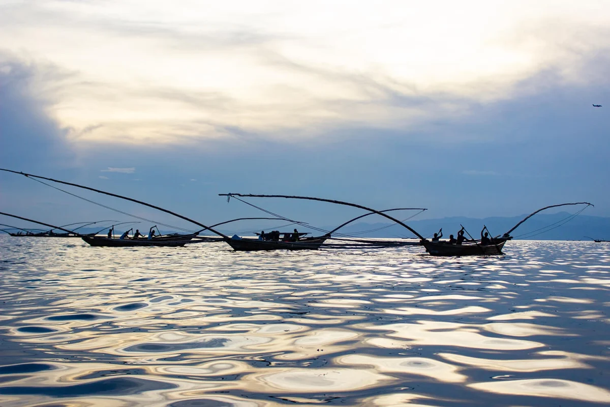
Lake Kivu -sunset
Some 1,370 square kilometers (529 sq mi) or 58 percent of the lake’s waters lie within DRC borders.
The lake bed sits upon a rift valley that is slowly being pulled apart, causing volcanic activity in the area.
The world’s tenth-largest island in a lake, Idjwi, lies in Lake Kivu, within the boundaries of Virunga National Park. Settlements on the lake’s shore include Bukavu, Kabare, Kalehe, Sake and Goma in the Democratic Republic of the Congo, and Gisenyi, Kibuye, and Cyangugu in Rwanda.
The amount of methane contained at the bottom of the lake is estimated to be 65 cubic kilometres (16 cu mi). If burned in a modern combined-cycle generating plant, that amount of methane would generate around 40,000 megawatts for an entire year, which is equivalent to the power output of six Grand Coulee Dams operating at peak springtime power. A future overturn and gas release from the deep waters of Lake Kivu would result in catastrophe, dwarfing the historically documented lake overturns at the much smaller Lakes Nyos and Monoun. The lives of the approximately two million people who live in the lake basin area would be threatened.

Lake Kivu sunset veiw
Cores from the Bukavu Bay area of the lake reveal that the bottom has layered deposits of the rare mineral monohydrocalcite interlaid with diatoms, on top of sapropelic sediments with high pyrite content. These are found at three different intervals. The sapropelic layers are believed to be related to hydrothermal discharge and the diatoms to a bloom which reduced the carbon dioxide levels low enough to precipitiate monohydrocalcite.
Scientists hypothesise that sufficient volcanic interaction with the lake’s bottom water that has high gas concentrations would heat water, force the methane out of the water, spark a methane explosion, and trigger a nearly simultaneous release of carbon dioxide, though the entry of 1 million cubic meters of lava during the January 2002 eruption had no effect. The carbon dioxide would then suffocate large numbers of people in the lake basin as the gases roll off the lake surface. It is also possible that the lake could spawn lake tsunamis as gas explodes out of it.
The risk posed by Lake Kivu began to be understood during the analysis of more recent events at Lake Nyos. Lake Kivu’s methane was originally thought to be merely a cheap natural resource for export, and for the generation of cheap power. Once the mechanisms that caused lake overturns began to be understood, so did awareness of the risk the lake posed to the local population.