
Mount Kenya
Mount Kenya (Kikuyu: Kĩrĩnyaga, Kamba, Ki Nyaa, Embu, Kirenyaa) is an extinct stratovolcano in Kenya and the second-highest peak in Africa, after Kilimanjaro. The highest peaks of the mountain are Batian (5,199 metres or 17,057 feet), Nelion (5,188 m or 17,021 ft) and Point Lenana (4,985 m or 16,355 ft). Mount Kenya is located in the former Eastern and Central provinces of Kenya; its peak is now the intersection of Meru, Embu, Kirinyaga, Nyeri and Tharaka Nithi counties, about 16.5 kilometers (10.3 miles) south of the equator, around 150 km (90 mi) north-northeast of the capital Nairobi. Mount Kenya is the source of the name of the Republic of Kenya.
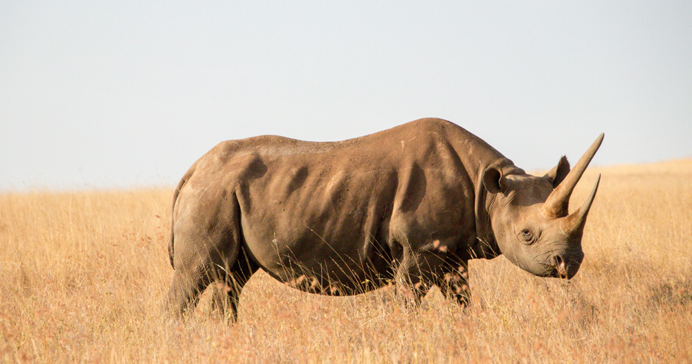
Black Rhino in Lewa Conservancy
Mount Kenya is a volcano created approximately 3 million years after the opening of the East African Rift. Before glaciation, it was 7,000 m (23,000 ft) high. It was covered by an ice cap for thousands of years. This has resulted in very eroded slopes and numerous valleys radiating from the peak. There are currently 11 small glaciers, which are shrinking rapidly, and may disappear by 2050. The forested slopes are an important source of water for much of Kenya.
There are several vegetation bands from the base to the peak. The lower slopes are covered by different types of forest. Many alpine species are endemic to Mount Kenya, such as the giant lobelias and senecios and a local subspecies of rock hyrax. An area of 715 km2 (276 sq mi) around the center of the mountain was designated a National Park and listed as a UNESCO World Heritage Site in 1997. The park receives over 16,000 visitors per year.
Mount Kenya National Park, established in 1949, protects the region surrounding the mountain. Currently, the national park is within the forest reserve which encircles it. In April 1978 the area was designated a UNESCO Biosphere Reserve. The national park and the forest reserve, combined, became a UNESCO World Heritage Site in 1997.
The Government of Kenya had four reasons for creating a national park on and around Mount Kenya. These were the importance of tourism for the local and national economies, preserving an area of great scenic beauty, conserving the biodiversity within the park, and preserving the water catchment for the surrounding area.
Kenya’s government has announced a project to discourage animals from straying into small holdings surrounding the Park and devastating crops. The project will see the Park enclosed by an electric fence with five electrified strands. Kenya’s Rhino Ark Trust, a non-profit organization, has been putting up fences in key areas around the country. As of 2021, 250 kilometers (160 miles) out of a planned 450 kilometers (280 miles) have been constructed in the Mt. Kenya area.[18] The fence discharges an electric shock, but is not dangerous to humans or animals.
The main ethnic groups living around Mount Kenya are Kikuyu, Ameru, Embu and Maasai. The first three are closely related. They all see the mountain as an important aspect of their cultures. All these cultures arrived in the Mount Kenya area in the last several hundred years.
Several ethnic groups that live around Mount Kenya believe the mountain to be sacred. They used to build their houses facing the mountain, with the doors on the side nearest to it.
The Kikuyu people live on the southern and western sides of the mountain. They are agriculturalists, and make use of the highly fertile volcanic soil on the lower slopes. They believe that God, Ngai or Mwene Nyaga, lived on Mount Kenya when he came down from the sky. They believe that the mountain is Ngai’s throne on earth. It is the place where Gĩkũyũ, the father of the tribe, used to meet with God. Thus, according to the Kikuyu records, Gĩkũyũ is the first person on Earth to ascend the mountain. ‘Mwene Nyaga’ in the Kikuyu language can also translate as the “Owner of the Ostriches” or “Owner of the white patches (of snow)” where ‘Mwene’ translates to ‘owner’, and ‘Nyaga’ to Ostriches or white patches. The snow (in Kikuyu: Ira) caps of the mountain represent a crown on God’s habitation. Kikuyu used to build their houses with doors facing the mountain. The Kikuyu name for Mount Kenya is Kirima Kĩrĩ Nyaga (Mt.Kirinyaga), which literally translates to the mountain that has the “Nyaga” – Ostriches. The mountain, therefore, is locally accepted as ‘God’s Resting Place’ or ‘Where God Lives’.
The Kikuyu name for Mt. Kenya is Kĩrĩnyaga which literally means ‘the one with the ostrich’. The ostrich has black or brownish–grey feathers with patches of white. The Kikuyu attributed an ostrich’s likeness to an object that was dark colored with white patches. The name Kĩrĩnyaga therefore figuratively means ‘the one with white patches’, referring to the glaciers among the peaks of the mountain.
Translated to the Kamba language, kĩrĩnyaga, would be ki nyaa. This is the name that Ludwig Kraph was given when he sighted the mountain from Kitui (in Kamba country). He recorded it as Kenya. It became the name of not only the mountain but also the country.
The Embu people live to the south-east of Mount Kenya, and believe that the mountain is God’s home (the Embu word for God is Ngai or Mwene Njeru).The Embu name for Mount Kenya is Kirenyaa. The mountain is sacred, and they build their houses with the doors facing toward it. The Embu people are closely related to the Ameru and Mbeere people.
The Ameru occupy the east, north, and north-western slopes of the mountain. They are generally agricultural and keep livestock and occupy what is among the most fertile land in Kenya. The Meru god Murungu was from the skies. Their name for Mt. Kenya is Kirimara, which means ‘mountain with white features’.
Mount Kenya lies in the Kenyan highlands, 150 km (90 mi) north-northeast of Nairobi, just northeast of Nyeri.
The Maasai are semi-nomadic people, who use the land to the north of the mountain to graze their cattle. They believe that their ancestors came down from the mountain at the beginning of time. The Maasai name for Mount Kenya is Ol Donyo Keri, which means ‘mountain of stripes’, referring to the dark shades as observed from the surrounding plains. At least one Maasai prayer refers to Mount Kenya:
God bless our children, let them be like the olive tree of Morintat, let them grow and expand, let them be like Ngong Hills like Mt. Kenya, like Mt. Kilimanjaro and multiply in number.
Mount Kenya was a stratovolcano. The lower slopes are still this shape, which is how the previous height is estimated. The central peaks of Mount Kenya are volcanic plugs that have resisted glacial erosion.
Mount Kenya is a stratovolcano that was active in the Plio-Pleistocene. The original crater was probably over 6,000 m (19,700 ft) high; higher than Kilimanjaro. Since it became extinct there have been two major periods of glaciation, which are shown by two main rings of moraines below the glaciers. The lowest moraine is found at around 3,300 m (10,800 ft). Today the glaciers reach no lower than 4,650 m (15,260 ft). After studying the moraines, Gregory put forward the theory that at one time the whole summit of the mountain was covered with an ice cap, and it was this that eroded the peaks to how they are today.
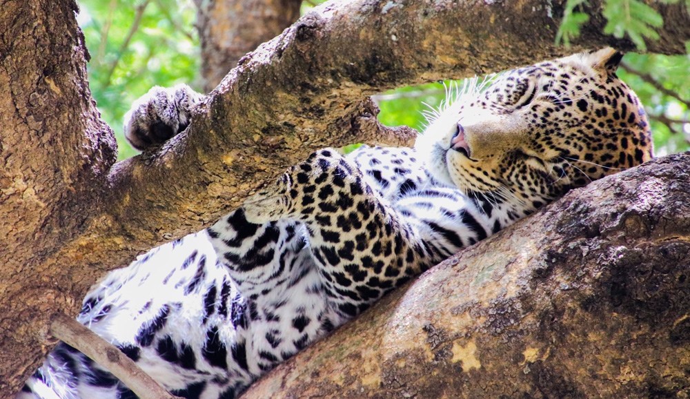
Leopard on a Tree
The lower slopes of the mountain have never been glaciated. They are now mainly cultivated and forested. They are distinguished by steep-sided V-shaped valleys with many tributaries. Higher up the mountain, in the area that is now moorland, the valleys become U-shaped and shallower with flatter bottoms. These were created by glaciation.
When Mount Kenya was active there was some satellite activity. The northeastern side of the mountain has many old volcanic plugs and craters. The largest of these, Ithanguni, even had its own ice cap when the main peaks were covered in ice. This can be seen by the smooth summit of the peak. Circular hills with steep sides are also frequent in this area, which are probably the remains of small plugged vents. However, as the remaining mountain is roughly symmetrical, most of the activity must have occurred at the central plug.
The rocks that form Mount Kenya are mainly basalts, rhomb porphyrites, phonolites, kenytes and trachytes. Kenyte was first reported by Gregory in 1900 following his study of the geology of Mount Kenya.
The geology of the Mount Kenya area was first described scientifically by Joseph Thomson in 1883. He saw the mountain from the nearby Laikipia Plateau and wrote that it was an extinct volcano with the plug exposed. However, as he had only seen the mountain from a distance his description was not widely believed in Europe, particularly after 1887 when Teleki and von Höhnel ascended the mountain and described what they considered to be the crater. In 1893 Gregory’s expedition reached the Lewis Glacier at 5,000 m (16,400 ft). He confirmed that the volcano was extinct and that there were glaciers present. The first thorough survey by Europeans was not undertaken until 1966.
The peaks of Mount Kenya are almost all volcanic origin. Most of the peaks are located near the Centre of the mountain. These peaks have an Alpine appearance due to their craggy nature. Typically of Alpine terrain, the highest peaks and gendarmes occur at the intersection of ridges. The central peaks only have a few mosses, lichens, and small alpine plants growing in rock crevices. Further away from the central peaks, the volcanic plugs are covered in volcanic ash and soils. The vegetation growing on these peaks is typical for their vegetation band.
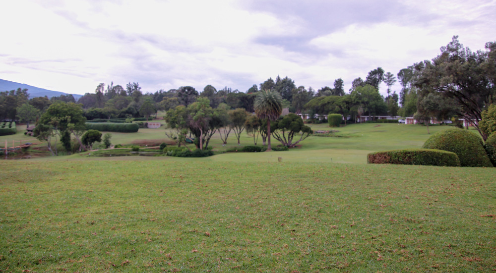
Beautiful landscape at the Mount Kenya Safari club
The highest peaks are Batian (5,199 m or 17,057 ft), Nelion (5,188 m or 17,021 ft) and Lenana (4,985 m or 16,355 ft). Batian and Nelion are within 250 m (270 yd) of each other, separated by the Gate of the Mists gap of 5,144 m (16,877 ft). Corydon Peak (4,960 m or 16,273 ft) is the next-highest, but unlike the previous peaks it does not form a part of the central plug.
Other peaks around the central plug include Pt Piggot (4,957 m or 16,263 ft), Pt Dutton (4,885 m or 16,027 ft), Pt John (4,883 m or 16,020 ft), Pt John Minor (4,875 m or 15,994 ft), Krapf Rognon (4,800 m or 15,748 ft), Pt Peter (4,757 m or 15,607 ft), Pt Slade (4,750 m or 15,584 ft) and Midget Peak (4,700 m or 15,420 ft). All of these have a steep pyramidal form.