
Kigali City
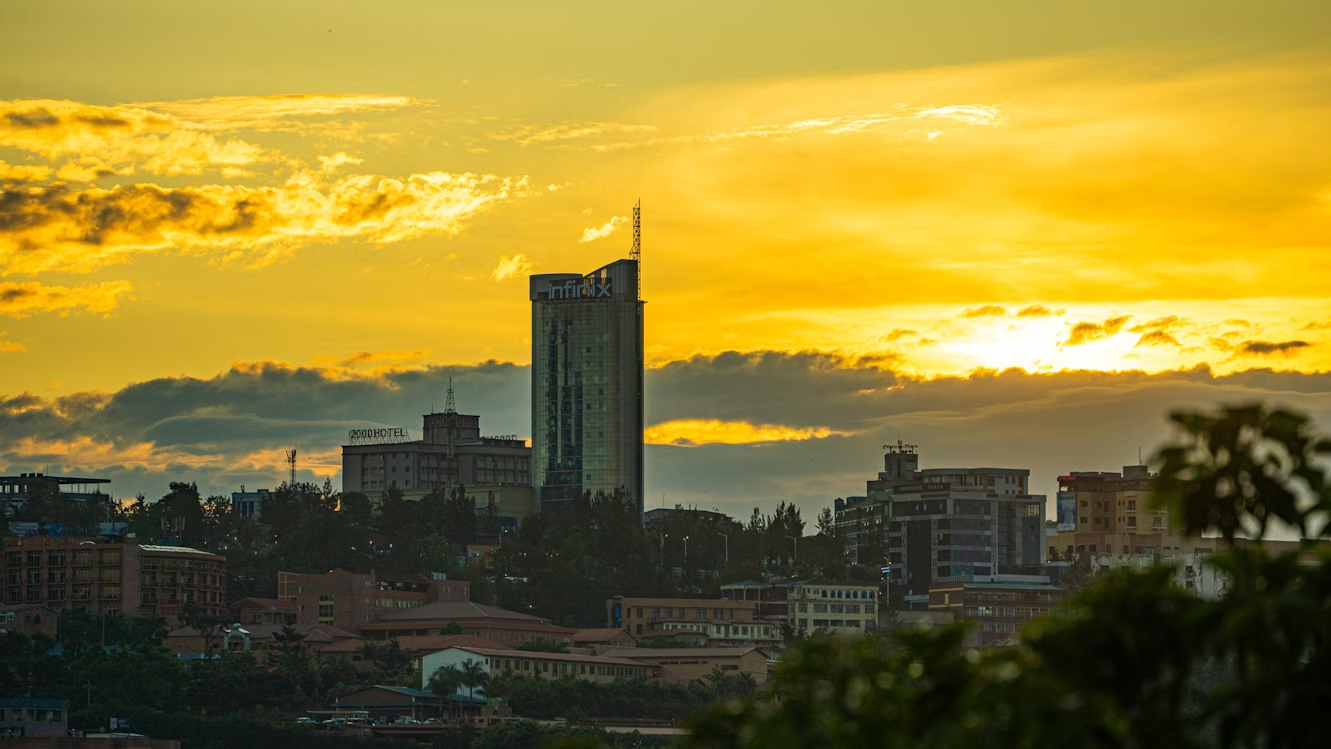
Kigali is the capital and largest city of Rwanda. It is near the nation’s geographic center in a region of rolling hills, with a series of valleys and ridges joined by steep slopes. As a “primate city”, Kigali is a relatively new city. It has been Rwanda’s economic, cultural, and transport hub since it was founded as an administrative outpost in 1907, and became the capital of the country at independence in 1962, shifting focus away from Huye.
In an area controlled by the Kingdom of Rwanda from the 15th century, and then, by the German Empire in the beginning of the 20th century, the city was founded in 1907 when Richard Kandt, the colonial resident, chose the site for his headquarters, citing its central location, views and security. Foreign merchants began to trade in the city during the German era, and Kandt opened some government-run schools for Tutsi Rwandan students. Belgium took control of Rwanda and Burundi during World War I, forming the mandate of Ruanda-Urundi.
Kigali remained the seat of colonial administration for Rwanda but Ruanda-Urundi’s capital was at Usumbura (now Bujumbura) in Burundi and Kigali remained a small city with a population of just 6,000 at the time of independence.
Kigali grew slowly during the following decades. It was not initially directly affected by the Rwandan Civil War between government forces and the rebel Rwandan Patriotic Front (RPF), which began in 1990. However, in April 1994 Rwanda’s President Juvénal Habyarimana was killed when his aircraft was shot down near Kigali. His death was followed by the Rwandan genocide, with Hutu extremists loyal to the interim government killing an estimated 800,000-1,000,000 Tutsi and moderate Hutu nationwide. The RPF resumed fighting, ending a cease-fire of more than a year. They gradually took control of most of the country and seized Kigali on 4 July 1994. Post-genocide Kigali has experienced rapid population growth, with much of the city rebuilt.
The city of Kigali is one of the five provinces of Rwanda, with boundaries set in 2006. It is divided into three districts—Gasabo, Kicukiro, and Nyarugenge—which historically had control of significant areas of local governance. Reforms in January 2020 transferred much of the districts’ power to the city-wide council. The city also hosts the main residence and offices of the president of Rwanda and most government ministries. The largest contributor to Kigali’s gross domestic product is the service sector, but a significant proportion of the population works in agriculture including small-scale subsistence farming. Attracting international visitors is a priority for city authorities, including leisure tourism, conferences, and exhibitions.
The name Kigali comes from the Kinyarwanda prefix ki- combined with the adjective suffix -gali, which means wide or broad. This was originally applied to Mount Kigali, most likely because the mountain itself was broad and wide, with the city later being named after the mountain. According to Rwandan oral history, the name originated in the 14th century. Rwandan scholar Alexis Kagame, who did extensive research into the country’s oral history and traditions, wrote that the name Kigali came into use after King Cyilima Rugwe completed a conquest of the area. The legend states that Rugwe viewed the territory from the top of a hill and said burya iki gihugu ni kigali, which translates to “this country is vast.”
Kigali is in the center of Rwanda, at 1°57′S 30°4′E. Like the rest of Rwanda it uses Central Africa Time, and is two hours ahead of Coordinated Universal Time (UTC+02:00) throughout the year. The city is coterminous with the province of Kigali, one of the five provinces of Rwanda introduced in 2006 as part of a restructuring of local government in the country. The city has boundaries with the Northern, Eastern and Southern provinces. It is divided into three administrative districts—Nyarugenge in the south west, Kicukiro in the south east, and Gasabo, which occupies the northern half of the city’s territory. The built-up urban area covers about 70 per cent of the municipal boundaries. Kigali lies in a region of rolling hills with a series of valleys and ridges joined by steep slopes. It is situated between Mount Kigali and Mount Jali both of which have elevations of more than 1,800 m (5,906 ft) above sea level while the lowest areas of the city have an altitude of 1,300 m (4,265 ft). Geologically, Kigali is in a granitic and metasedimentary region, with lateritic soils on the hills and alluvial soils in the valleys.
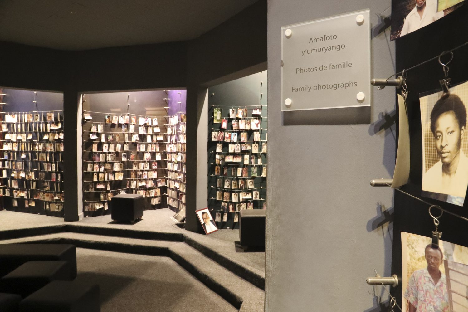
Kigali genocide museum
The Nyabarongo River, part of the upper headwaters of the Nile forms the western and southern borders of the administrative city of Kigali although this river lies somewhat outside the built-up urban area The largest river running through the city is the Nyabugogo River, which flows south from Lake Muhazi before flowing west between Mount Kigali and Mount Jali, and draining into the Nyabarongo. The Nyabugogo is fed by various smaller streams throughout the city, and its drainage basin contains most of Kigali’s territory other than areas in the south which outflow directly to the Nyabarongo. The rivers are flanked by wetlands, which act as a water store and flood protection for the city, although these are under threat from agriculture and development. The “Umusambi Village” is a restored marshland in Kigali that serves as a shelter for vulnerable grey crowned cranes.
As of the 2012 Rwandan census, the population of Kigali was 1,132,686 of which 859,332 were urban residents. The population density was 1,552 inhabitants per square kilometer (4,020/sq mi). At the time of independence in 1962, Kigali had 6,000 inhabitants, consisting primarily of those associated with the Belgian colonial residency. It grew considerably after being named as the independent nation’s capital although it remained a relatively small city until the 1970s due to government policies restricting rural-to-urban migration. The population reached 115,000 by 1978, and 235,000 by 1991. The city lost a large fraction of its people during the 1994 genocide including those killed and those who fled to neighboring countries. From 1995 the economy began to recover, and large numbers of long-term Tutsi refugees returned from Uganda. Many of these refugees settled in Kigali and other urban areas, due to difficulty in obtaining land in other parts of the country. This phenomenon, coupled with a high birth rate and increased rural-to-urban migration, meant that Kigali reattained its previous size quite quickly and began to grow even more rapidly than before. The population exceeded 600,000 in 2002, and in the 2012 census had almost doubled to 1.13 million, although this was in part because the administrative boundaries of the city had been expanded.